
Grumpy Old Men's Climbing Club 2026
We are the pilgrims, master
Always a little further, it may be
Beyond that last blue mountain barred with snow
Across that angry or that glimmering sea.


Grumpy New Year to all
Mayhem and chaos on the embankment - right. No, we wern't there, these pics are curtesy of our television.
We hosted a little dinner party on New Years Eve. Our guests were nearly as old as us and by 11 O'Clock, after a heated session of Scattagories we began to fade out and the evening celebrations descended into the sound of gentle snoring. Sue retired to bed and our guests shuffled off home.
All alone but not deterred, or only slightly deterred I stuck it out until 12 O'Clock and watched the late show with Jools Holland until the london extravaganza started. As spectacular as ever.
February 2026. From Richard Haszko, the mountains of Egypt. What? No pyramids?


What’s For Desert?
‘Where are you from? I asked the couple in front of us in the minibus taking Valerie and I from Hurghada airport to our hotel on the shores of the Red Sea. ‘Shropshire’ said the man in front. ‘Where in Shropshire? Asked Valerie. ‘Telford’ was the reply. ‘So am I. Where in Telford?’ ‘We live in Lee Gomery.’ ‘I live in Madeley’ Valerie told them. ‘We know it well’ came the response. Thus began a conversation which nicely filled the 70 minute bus ride.
That’s how we got to know Mick and Tracy and when over dinner that evening Mick said he was going to be 60 soon and wanted to go up 60 named tops this year to raise money for charity and he’d got two in mind in the desert behind the hotel I was interested. ‘I’ll go with you if you like’ I said. I knew there were organised desert walks from the hotel but I didn’t think they went the way Mick had in mind. ‘There’s CKW and Miss Ilgin’s Hill on Google maps so we can do those.
Two days later we met at 8 and set off up the hotel drive. At the gate we had to sign a disclaimer telling us about the dangers of the desert, no rescue etc. but we weren’t concerned. Following directions on Mick’s phone we walked along the largely deserted road, passed by the occasional lorry carrying large blocks of stone. ‘Looks like they’re building another pyramid’ Mick quipped. Spotting a potential route to our first hill we stared up a dry riverbed only to be waved at by a man higher up next to a building. We waved back and carried on, at which point he was joined by another chap and they came down to us. With various gestures it became clear they didn’t want us going that way ant to go further along the road.
Crossing the southbound carriageway we were soon into another wide old riverbed. At it’d head was a small col which we soon reached. Hill CKW was up to our left and we quickly scrambled up steep very loose ground to the top. ‘Not going to be nice going down that’ I said to Mick and it wasn’t: sharp limestone blocks slipping away as soon as we touched them and horribly loose underfoot. Back at the little col we debated what to do next. Miss Ilgin’s Hill looked to be a long way off and we only had one bottle of water between us (me having foolishly not thought to bring one.) We looked up, we looked down and were just starting back but I didn’t really want to give up and neither did Mick. ‘There’s a faint track up this slope let’s go to the top and see what it looks like’ I said. From the top it there was an obvious path leading over to Miss Ilgin’s Hill and it didn’t too far away so we decided to go for it. I got summit fever and raced along, waiting for Mick just below the top so we could go up together. It was only 10 minutes from when we spied the hill in the distance. ‘Must be the opposite of foreshortening in the desert’ I opined, forelengthening.’
The top was marked by a sign that told us the hill was named after Miss Ilgin who was the wife of the man who first went up it in 2007 and started building the hotel. The obligatory photos were taken and it was time to head back. A little track led down quickly to a rocky area with some scrambling down the ancient limestone but it didn’t take us long to get down and back to the hotel in time for breakfast.
From Phil Kershaw

From back in the old days when we were proper climbers. This is Phil on the abseil from The Old Man of Hoy. Note the essential anchor rope to the top of pitch1.
Roy & Marilyn Small together with Sue & Tom Westgate have just spent a week ski touring in Hamn, on Senja, a large island 40miles as the crow flies (3.5 hours driving) South West of Tromso in the Norwegian Arctic Circle. Don’t go there expecting to see the Northern Lights or good weather as these are god given. We got out everyday although the weather varied from hail squalls to winter sun. However the Nordic noire is there to the full at this time of year – we all enjoyed a great week. Hopefully the photos give a flavour of our week.
Click to enlarge. Be patient with the first image, it might take a few seconds to download.
1-5


6-10


From the Gravelings John and Cath
La Geoda da Pulpi
At the end of our latest annual Winter 2 week climbing trip to Costa Blanca, we decided to have a change – to finish with something completely different - and booked 3 extra days in Cartagena.Set on the coast an hour or so drive south of Alicante, Cartagena is a delightful place, rich in Carthaginian and Roman history, and is well worth a visit in its own right.However, for us, Cartagena was primarily to be the base for a further trip south to visit a phenomenon that had been on our bucket list for some long time – La Geoda da Pulpi.
The visit entailed an hour’s drive further south to the long-abandoned Mina Rica silver mine just outside the small town of Pulpi in south-eastern Almeria Province.
The mine is home to the world’s largest geode which is located some 50m underground. A geode is a void formed from an air bubble in volcanic, metamorphic or sedimentary rock and is filled with crystals formed from mineral deposits.The Pulpi geode, which was only discovered in 1969, is 8 metres long, 2 metres wide, 2 metres deep and its interior is lined with huge translucent crystals of selenite (gypsum) up to 2m in length. It is the transparency, size and state of preservation that makes this geode globally unique.
Entry is by a pre-booked small group guided tour - which lasts about 90 mins – and is so popular that the tours get booked up months in advance.The tour was not physically demanding – easy walking through head height tunnels, passing lots of evidence of the previous mining of silver, lead, iron and zinc - and down ladders to the prime attraction.
Wearing face masks and gloves to avoid contamination, the geode is then viewed by laying flat and squeezing ones head and shoulders through a 2ft diameter aperture from which position the crystal interior of the geode can be seen in all its glory.
The only slight downside was that the tour guide only spoke Spanish and, though we had English audio guides, we felt that we may have missed some interesting asides.However, this was really a one-off experience and a must visit if you are ever in that area.
Interestingly, “marmite” Michael Portillo has just done a series travelling through Spain on Channel 5 and in the 6th programme, he went to Almeria and there is a 5 minute clip of him visiting the Mina Rica Mine and viewing the geode. If MP is not your cup of tea, you can scroll through the programme to the mine clip which comes at about 24 mins in.


News Flash News Flash News Flash
Roy has fallen off the slabs at Awesom Climbing wall and suffered grievous injury.

Roy, what were you messing at? It was only 6c+.
Monday 13th April.
Sad day, John Robson's funeral at Macclesfield crematorium. Well attended by Dot (of course) and members of John's familily. There was also a good showing of Grumpies to say farewell. Afterwards there was an excellent wake and buffet at the Cavendish Golf Club in Buxton.


In the past, John was awarded Grump of the Year, and questions were asked when this was. Gerry has kindly sent a definitive list.
-
2006: W. Wintrip
2007: J. Robson
2008: G. Rawcliffe
2009: G Douglas
2010: D. Turnbull
2011: G. Macnair
2012: J. Myers
2013: M. Harris
2014: M. Mortimer
2015: S. Cunnington
2016: G. Langsley
2017: Cath and John Graveling (Joint) - 2018: M. Mortimer
2019: T. Mays
2020: R. Small
2021: M. Waters
2022: J. Middleton
2023: A. Hubbard
2024: E Simpson
2025: D. Lockwood
News Flash from the Kalymnos Kronicle.
From our Wandering Daily Grump reporter john Graveling. UK holidaymaker bitten by poisonous spider.
Was it a Brazilian Wandering spider, or a Sydney Funnel-Web? Adey thinks it could have been either, or both..
-
A heated reply from Adey Hubbard.
I feel I should correct one or two minor inaccuracies in John Graveling's secondhand report.
Firstly, although approaching late middle age, 75 is a bit of a downer considering I am a mere 72.
Secondly, the spiders quoted are definitely not found on Greek Islands. However, the Mediterranean Recluse and the Mediterranean Black most certainly are. Since it was up my trousers and rapidly left after inflicting a double bite I cannot say which it was. However, upon viewing the said double lesion, the pharmacist said "Oh yes. Definitely a spider bit from one of the bad ones. We see several every year. You need an antibiotic with steroid cream to stop it getting much worse. For the princely sum of 10 Euros I have applied said cream 4 times daily and all is well.
Thirdly, although I have done some drinking of alcoholic beverages, it has been quite minimal and I have not knocked over any glasses of beer. It is Mr. Lockwood, together with a number of other noted Grumpies who shall remain nameless, who are keeping the Alpha and Mythos breweries going.
Finally, the scurrilous suggestion that we might be doing more ogling that climbing is totally out of order. We are far too mature and gentlemanly to be ogling, apart from a couple of ladies having a swim yesterday. I, of course, averted my eyes.
When you hear new reports of an injurious encounter with a strand of very rusty old fence wire, buried within the shrubbery amounst piles of goat poo on the descent from a new crag near Arginonta, they are correct. General advice to the effect of hoping my tetanus jabs were up to date, which they very probably are not at all, prompted a trip to Kalymnos Hospital this morning. All extremely efficient; the round trip took under an hour. The doctor there agreed that an injection of tetanus antibody would be a really good idea. I am now full of antibodies so, once again, all is well.
Oh yes, Dave and I have also done some climbing and plan to do some more; just so you know. Bill G and Darryl managed a 7a and a 7a+ between them, yesterday. Good effort!
Yours very sincerely,
Top Grumpy Climber, aged 72
A likely story.
Dave, I have just learned that There's forty Farsend Fevvers on a Frush. Can this be true?
I think that I feel one of my headaches coming on.
Shetland by Campervan May-June 2026
We took the overnight car ferry from Aberdeen to Lerwick, the capital of Shetland. It's just a small town with all the usual shops, light industry and extensive docks but it also had an interesting old town and garrison.We soon located Tesco and were able to stock up for the next week then off to our first campsite at the curiouslly named South Nestings, about 10 miles north of Lerwick. This was one of several immaculate community run sites that we used on the various islands. Arrival day was calm but all hell let loose the following day with violent sleety sqalls and 60 mph gusts from the north. A day for hunkering and finding out where we'd stashed essentials in the campervan. There was, however decent wifi, phone and television signal.
The main attrection of Shetland is its coastal scenery, no-one but a sad obsessed bog trotter would venture inland onto the featurelass moorlands of endless tussocks.
1-6


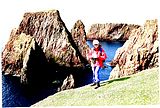
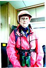

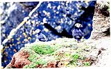
1.Old Lerwick
2. Sue locates gluten-free carrot cake
3. The stacks of Westerwick.
4. Ready to go.
5. Sue in an ironage roundhouse at Jarlshof, Sunbergh Head.
6. Puffins at Sunbergh Head.
There are endless archaeological remains scattered across Shetland. Most are in ruins, sometimes they just fell down, other times the local stole all the stones to build their houses. Outrageous. However, on the small offshore island of Mouse (no rats or mice allowed) there is the tallest free-standing broch in Europe.
7-13

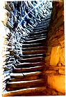
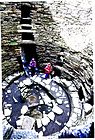


7. The Mousa broch and Shetland ponies.
8. Inside the double walls are staircases.
9. The narrow entrance on the seaward side,
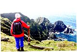
10. The monstere cliffs at the back of Fitful Head. Down below they were filming the next instament of Shetland. Were Tosh and Ruth there? Of course they were.
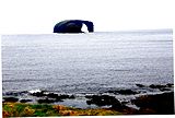
11. The Grazing Horse of Dore Holm island.
12. Some of the dramatic cliff scenery on the Esha Ness peninsula.
13. So now you know, Hillswick school, Bruck? Rubbish.
14-19


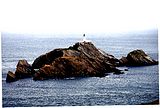
One of the must-dos on any island it to visit its extreme bits. Shetland has three main islands, Mainland, Yell and Unst, Though Fetlar would argue this. The most northern part of Mainland is Fetherland, a lonely peninsulat, the site of a long abandoned fishermen's village and a remote lighthouse. Long walk but the peninsula sports some huge cliffs. Stacks are everywhere though few have been climbed. Next day we took the interisland ferries and visited Yell, the second largest of the Shetland archipeligo and then Unst, famous for the most northerly bit of the UK at Muckle Flugga, and the location of the very rare Edmonston's Chickweed which grows nowhere else in the world.
14. The clffs of Fetherland. Spot the lighthouse.
15. The Drongs. Climbed by Mick Fowler and friends in 1995.
16. The famous Unst bus shelter.
17. Edmunston's Chickweed.
18. Gannet colony Hermanes peninsula
19. Muckle Flugga.
Five go mad in Pembrokeshire (3rd to 7th August 2026)
My call-out to Grumpies interested in a jaunt to Pembroke was mostly met with silence, though it eventually produced six or seven expressions of interest.
At the final shake-down, five intrepid adventurers signed up.
We consisted of four hoary old men with a couple of hundred years of trad climbing experience between us - John Jones, Dick Turnbull, Frank Connell (known in Grumpy circles as Frank the Decorator), me, plus a strip of a lad (the always obligatory young’un, there to be shown the ropes), Bill Geary.
After the long drive down on the Monday, what followed was a steady three days’ climbing at Saddle Head, Crickmail Point and Stennis Head. The first two crags required an abseil but thankfully some early birds had got there before us and set up the rappels.
We might have been a bit teetery at times, but we managed to hold it together, whilst climbers around us and in the distance were taking flyers.
My thoughts on my first lead were:
“Why do I feel so heavy?”
“What do I do with these lumps of metal hanging from my waist?”
“And what on earth are they called?”
Dick & Frank’s was a climbing partnership made in heaven (or, apparently, fashioned by Ken Wilson, which I understand amounts to much the same thing).
John Jones had been no mean adventurer himself, with first ascents to his name. His & Dick’s accounts (in the plural) of their Pembrokeshire route Promised Hand just about bore repetition. As did Dick’s epic tale of Frank dropping two belay devices prior to a 27 abseil descent of the Croz Spur on the Grandes Jorasses.
My only claim to fame with regard to new routing was, when on the Range West trespass, despite featuring in the new route list which Dave Cook compiled afterwards & published in Mountain magazine, my name & those of my co-first ascensionists were subsequently expunged from the record when the new Pembrokeshire guidebook came out. Fame is a fickle & often short-lived friend. I’m not bitter!
Throughout our stay at May Cottage, the evenings were punctuated, or you could say dominated, by stirring (and very loud) tales of derring-do. Somewhat surprisingly there were no complaints from the other parties there, who could not but have helped hearing everything from our team. (I soon realised that I was the only member of our group who did not have a hearing impairment!)
We were on top of the full range of logistical challenges on this trip, the most difficult one being the disposal of our ever-increasing collection of empty wine and beer bottles. A notice informed us that there was no bottle bin at May Cottage and, despite having one non-drinker (Frank) amongst us, we rapidly filled up the boot of Dick’s car, whilst looking for, or forgetting to look for, a bottle bank, such that towards the end of our stay we had difficulty in finding space for our climbing sacks.
Frank had told us that in an earlier life he had taken the “Queen’s Shilling” and signed up for the army. I later realised that, similarly, by accepting a piece of Bill’s flapjack at Stennis Head, I had been effectively Shanghaied into seconding him up Manzoku, a route I had led 30 years ago and naively though I’d have little trouble with on a top rope. E1? Ridiculous! Steep, polished and painfully awkward. There are some photos of me topping out, which I have chosen not to share!
Some of the photos that we did take suffered from the rather drab and muted clothing three of us were usually clad in. I remember meeting Carl Ryan, esteemed climbing photographer, at the top of a crag years ago when he was bemoaning the change in climbing fashion from bright to dull. “Those were the days when Andy Pollitt and his mates were climbing!” he reminisced.
Well, he would have been delighted to see Frank in his pantomime pantaloons (ex-Mike Mortimer’s, I understand).
Whilst photographing I inadvertently pressed a button on my phone which changed my colour photos to black and white. (I always liked those old black & whites, particularly in the early Gogarth guidebooks.)
(Talking of black and white, hanging on the wall at May Cottage was a b&w photo of Roy Small on Mysteries, taken by Chris Jackson. (Who?)
On my return to Awesome Walls I just had to check with Roy that he wasn’t still wearing the same Ron Hills.)
All in all, a great trip. To be repeated next year??
1-6 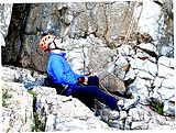


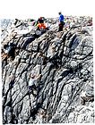
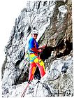
1. John belaying below Limbo, thinking "How am I going to get up that?!"
2. Busy day on the crags.
3. John Jones getting stuck in on Limbo at Stennis Head
4 & 5. Dick sort of belaying.
6. Frank the circus clown.
7-11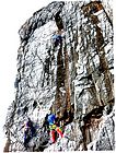
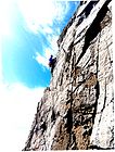
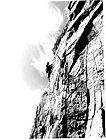
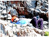
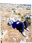
7. Dick and Bill on Saddle Head.
8 & 9 Dick posing.
10. John chilling.
11. Take it easy, John.
September The Jacksons go to Welsh Wales again.
And where have those wandering Jacksons been this time? Well, Wales (for a change?) but this time checking out some of the middle bits that we seem to have missed. We stayed at six different campsites over the holiday, spending 4 or 5 days at each. We started off at Chirk, and stayed in the pleasant Lady Margaret's Park CAM campsite. Chirk is historic border town and community in Wrexham County Borough, Wales , sitting on the River Ceiriog near the border with Shropshire. So, only just in Wales but we stayed there to visit its historic castle and to join friends Howard and Janet who live in Mold, or Yr Wyddgrug which is definitely in Wales. Chirk is also close to Llangollen with its limestone escarpments and scenic canal.
Roger Mortimer built a fortress at Chirk to secure Edward 1’s grip on newly conquered Wales. By 1310, its formidable round towers, curtain walls, and gatehouse - complete with double portcullis, arrow slits, “murder holes,” and a dungeon carved from bedrock - stood as a stark symbol of English dominance. It's now owned by the National Trust. There are also pleasnt gardens though many of the flowers had gone to seed due to it being late September.
The nearby site of the Battle of Crogen is an engagement said to have taken place during Henry II's summer 1165 campaign against an alliance of princedoms led by Owain Gwynedd. Later Welsh chronicles recorded that a detachment of Welsh troops inflicted a number of casualties on the Anglo-Norman army in the Ceiriog Valley. Henry subsequently abandoned the campaign after an attempt to cross the Berwyn mountains was thwarted by severe weather.
1-6


-
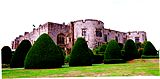
1. Chirk Castle
-
2. Sue in the Chirk castle dungeons
-
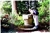
3. A font has been stolen. Sue is looking into it.
-
4. Bad times back in 1165. Henry II may have won, or not..
-
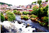
5. Llangollen.
-
6. Sue's new tattoo!. Left buttock this time.
We tramped up and down the Llangollen canal path, which, despite being level, after 8 or 9 miles it became quite wearing. By obligation, we had to cross the famous Froncysyllte aquaduct which was populated by overexcited narrowboaters and was controlled by stop-go men as there are no passing places on it..
The aqueduct was designed by civil engineers Thomas Telford and William Jessop for a location near an 18th-century road crossing, Pont Cysyllte After the westerly high-ground route was approved, the original plan was to create a series of locks down both sides of the valley to an embankment that would carry the Ellesmere Canal over the River Dee. After Telford was hired the plan was changed to an aqueduct that would create an uninterrupted waterway straight across the valley. Despite considerable public scepticism, Telford was confident his construction method would work because he had previously built a cast-iron trough aqueduct. The Aqueduct was compleated ib 1805.
This wasn't the only Aqueduct, we encountered on our walk, there was another one near Chirk, and on our way we passed through two quite long tunnels.
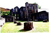
From Llangollen we also visied the ruins of Valle Crucis Abbey, which was probably very impressive until Henry VIII's thugs burnt it down. Even so...
Onwards and downwards, hills and sheep, sheep everywhere, sheep with pointy ears, sheep with black noses, tails and no tails, grumpy looking and chirpy. On our way we visited Powis Castle which was a little disappointing as it was closed for roof repairs. The gardens were impressive for those who like monumantal yew hedges and seeds.
Eventually we arrived at the pleasant market tow of Rhayader where we stayed at the CCC campsite on the banks of the River Wye. Wyeside I believe it was called. It was a good centre for walking in a rarely walked hinterland.
Rhayader was a busy, historic market town, named after 'Rhayadr Gwy' a Welsh name for a local waterfall on the Wye. It is actually the very first town on the banks of the beautiful River Wye and has long been an important centre for the surrounding farming community with its flourishing livestock market.
It is also said to be the oldest town in mid Wales. Sitting in the shadow of the Cambrian Mountains at the upper end of the Elan Valley, Rhayader has a long history as a market town. Because of its location at a natural crossroads between east, west, north and south, Rhayader has welcomed travellers for centuries. In days gone by it was a very important staging post, especially for the London to Aberystwyth route.
Southbound again, Brecon. A well designed CAM campsite about 1 mile from Brecon town,and which would have been near perfect were it not for the adjacent rifle range. Needing to get some ascent under our belts, we chose to climb a lesser bump in the Beacons named Pen y Bryn. I say lesser but it was still 562m above sea level. After several miles of canal path, we boldly struck inland, onwards and upwards on a relentless soggy slog to an indeterminate summit. We eventually located a cairn so that was probably the top. The OS map indicated an ancient quarry and lagoons on the summit but they seemed to have been subsumed by sedge and tussock. Recommendations? Don't bother.
7-12
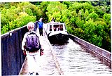


7. Froncysyllte Aqueduct along with overexcited narrow boaters.
8. Valle Crucis Abbey, or the remains of it after Henry VIII's thugs rather ruined it.
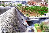
9. Caban Coch reservoir wall and the source of the river Elan
10. Anyone spotted a blue phone box around here?
11. Less than spectacular summit of Pen y Bryn.
12. Manorbier Castle entrance.
When I was a climber, back in the old days, I and a group of friends used to visit Pembroke every Easter and stay in static caravans at Manorbier. The campsite was just behind the castle and it seemed to be still there. No tourers though so we opted for the nearby Kelpie Tents which turned out to be a large slightly sloping field with dodgy portaloos. Well, it did have electric and a water tap so what can you expect for £25 a night? Shall not be back there.
However, back in the eighties the rather magnificent Manorbier Castle was closed to visitors, now it is open and well worth a visit. We did some pleasant coast walking in the direction of Tenby. Further than it looks on the map.
Onwards and downwards (well sideways actually) we stayed at the excellent Caerfai Bay campsite, just south of St Davids. Charging little more that the field at Manorbier, this site was well appointed, excellent ameanities and a pitch with a view.
As well as visiting St Davids, we discovered some excellent coastal walks from here including the coast path, past Solva to Pendine, famous for its sands and Where we just managed to catch the bus back to St Davits.
13-18


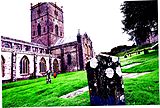


13. Between the walls of Manorbier Castle.
14. 12C Church of St James the Great, Manorbier
15. 12C Gerald of Wales. Friend of Henry II.
16. St David's Cathedral.
17. More of St David's Cathedral
18, Remains of The Bishops Palace.
Round the bend now, pointing more generally North in the home direction we moved on towards Cardigan Bay and stayed at On The Farm campsite near Aberaeron which was pretty good and only minute's walk from the coast path and the beautifully painted town of Aberaeron. South, we took the bus to the chocolate box seaside town of New Quay and walked back along the delightful and spectacular coast path. North, took the bus to LLanrhystud and walked back along the coast and in between these days we walked inland (in the rain) to the National Trust house of LLanerchaeion, much of which was designed by the famous architect John Nash, born 1752. Lots of false doors and things, rooms were only allowed one window. The walled garden was OK but was looking in need of some care and attention.
19-24

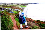

19. Sue at the most westerly point of Wales.Pen Dal-Aderyn. Ramsey Island in the distance.
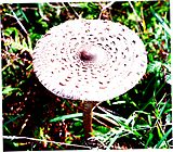
20. Parasol mushrooms were everywhere along this stretch of coast.
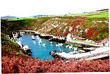
21. Solva
22. Pendine sands.
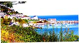
23. New Quay
24. Aberaeron
Graham and Helen Gibson Hoey, The Beckey-Chouinard’ August 2023
The Bugaboos are a range of impressive granite spires in eastern British Columbia, Canada; home to a large number of classic mountaineering routes. Perhaps the most famous and sought after is Fred Beckey and Yvon Chouinard’s line up the west face of the South Howser Tower, first climbed in 1961. Featured in the 1979 publication Fifty Classic Climbs of North America it is widely considered to be a ‘crowning jewel in Canadian alpine climbing’. As a sign of the esteem in which the route is held internationally, it is known simply as The Beckey-Chouinard.
It is described in Mountain Project as follows: A Bugaboos mega-classic that draws climbers from around the world and for obvious reasons. It's 2000' tall and has pitch after pitch of 5.8 and 5.9 climbing with short sections of 5.10 thrown in here and there for good measure. The elegant line follows a large buttress that soars up the full height of the west face. This is a full value route with excellent climbing, great position and spectacular views. Not to be missed.
It has 19 pitches to the main summit, varying from HS to around E2, with around 9 at HVS and above. We actually ended up splitting a couple of pitches for convenience and ended up doing 21 pitches. We also climbed a 5.10 variant on the upper wall. The nature of the climbing is, in general, extremely physical and sustained following corners, chimneys and cracks, from finger to offwidth. Its Alpine Grade IV reflects its nature as a multi-pitch route in a remote, high-altitude alpine environment with significant commitment. That said, nowadays, if you’ve got a satellite phone (we hadn’t), a helicopter is about a 15 min ride away!
August 14 2023 Helen and I crawled gingerly along the badly pot-holed dirt road in our 2x2 hire car for around 50km before arriving at theTrailhead. We arranged the protective screen of chicken wire around the car and set off. The wire is to prevent porcupines from chewing tyres, brake pipes and electrical wiring - there’s always a new experience in climbing, even after 50 years of doing it. A typical Alpine approach ensued, a pleasant, flat, pine-scented forest followed by a long slog up zigzags, ladders and chains, eventually arriving at the beautifully-sited Conrad Kain Hut. Text and images can’t prepare you for the stunning view of the Bugaboo Spires which form the hut’s backdrop. We pitched the tent at Boulder Camp and spent a sleepless night worrying about the day ahead.
1-4


1 The Beckey-Chouinard
2 Trying to deter the porcupines!
3 Snowpatch Spire on the right, Hound’s Tooth on the left
4 The Conrad Kain Hut
August 15 2023 The ‘easy’ normal approach to the Howser Towers goes via a col between Bugaboo Spire and Snowpatch Spire, the BS col. Unfortunately, over the years, climate change had seen the snow slope which rendered the col accessible collapse earlier and earlier in the season and this approach was no longer available to us. An alternative is a longer approach up a steep, badly crevassed glacier followed by a descent down one of two steep gullies, which we hoped would be filled with snow. Another option is to hire a helicopter to take you directly to the East Creek camp below the route for around £3,000 return. We decided to walk and set off early! The summer’s heat had fortunately exposed the many crevasses but it was time consuming threading our way upwards and it was only by crossing a very thin and narrow snow bridge that we were able to access the upper part of the Bugaboo Glacier. We tried the left-hand of the two possible gullies leading down to the East Creek camp below the west face of the Howser Towers where we hoped to pitch our tent. Our hearts sank. There was no snow, just steep loose scree and rushing meltwater. I made one attempt, only to have my feet dragged away by the force of the water followed by a 3m slide down the mobile scree. Still hopeful, we headed over towards the second gully further north. We could only see into the middle section but spotted a couple of climbers making their way up it. The approach to the gully was cut off by the West Ridge of Pigeon Spire and it took some time for us to find a route over this and down onto the rocky col between Pigeon Spire and the Howser Towers, the Pigeon-Howser col. There was a tent here and it occurred to us that, as the descent from the route came to this col, it made more sense to camp here than carry all our gear down what could be a very difficult descent, only to have to go back a second time to retrieve it all and then climb back up. The decision was made to camp here and go down in the morning so we pitched our tent on a flat but sloping rock tied down to several boulders. Strong winds led to little sleep.
5-10


5 Our route (in red) from Boulder Camp to our camp at Pigeon-Howser Col (green dot). ‘X’ marks the top of the first gully we attempted to descend
6 Pigeon Spire with Bugaboo Glacier to the left
7 Well crevassed by mid August
8 The snow bridge
9 At Pigeon-Howser Col
10 Looking south-west from the Pigeon-Howser Col
August 16 2013 The next day dawned with a clear blue sky and we set off later than planned at 6:30 down the gully. At first it was very awkward, requiring care, and towards the bottom it steepened up considerably, eventually ending in a bulge of overhanging, iced-up scree, several metres above a snow slope. Fortunately, this could be bypassed, but only by traversing along and down steep, loose ice and gravel. Some heart-in-mouth moments saw us safe and relieved on the snow slope below. A long way away, the edge of the South Howser Tower formed the skyline, dwarfing Helen as she edged towards it. More descent, followed by 1000 ft of scrambling upwards took us, at last, to the start of the climbing proper. Above us lay 2000 ft of perfect white granite.
11-13


11 The approach (in red) from the Pigeon-Howser Col to the start of the route
12 The descent gully to East Creek
12a The descent gully almost exactly 7 years previously! Photo by Steph Abbeg
13 Helen, dwarfed by the South Howser Tower. The Beckey-Chouinard roughly follows the skyline
As well as the approach, another concern was the condition of the glacier on the east side of the towers which is used for the descent. The abseils end at a bergschrund with a steep snow slope below and, depending on the conditions, crampons etc may be needed, Because of this we were carrying our mountain boots, crampons and walking poles as well as food, meds, torches, water, emergency blankets, down jackets and waterproof/windproof jackets, phones etc, etc, which meant our sacks were heavy. Consequently, you can pretty much add a grade to each pitch. This was immediately felt on the first three ‘easy’ pitches following cracks up the crest of the buttress. Supposedly S to mild VS they all felt solid VS. The next pitch was the first crux. A crackline up flared cracks in a steep wall led to a powerful barndoor move off an arete requiring a heelhook and a long reach over a roof. Given 5.10a (E1 5b), it felt like a good E2 5c! Three more superb pitches up cracks, flakes and corners (The Great Dihedral!), followed by a scramble, led to a large ledge often used for bivouacs (the Gravel Ledges). It is quite common to bivouac on the route, either here, at the foot of the final tower or on the summit. However, we were hoping not to have to do so but had made some provision for it. A few more strenuous cracks and chimneys led to Sandy Ledge at the foot of the final tower: the Great White Headwall. Here things moved up a notch. The first pitch was a hand to fist to offwidth through a niche, just great when you are carrying sacks! At the stance we looked despairingly at the next pitch, a corner leading into a wide, unprotectable, horrible-looking squeeze chimney. Above us, not far above the stance, a sinuous crack led tantalisingly upwards; the Fingers Variant. Steep? Certainly. Protection? Definitely. Good holds? Hopefully. I set off up the corner then moved left onto the wall. Here the exposure was tremendous and the climbing superb. It was a long, demanding pitch with no rests but plenty of gear. The sack seemed to get heavier and heavier as I ascended. With 10m to go I could see one possible placement; I took a deep breath and pressed on. Two metres above my last piece, the Gods smiled on me; there was a hidden piton! I reached the belay ‘running on empty’. But it was far from over yet. It was becoming increasingly windy and cold. The remaining pitches blurred into a series of strenuous corners, chimneys, cracks and grooves, all around E1. Finally, a tension traverse off a piece of tat along with some thin wall climbing (the only bit in 2000 ft!) led into a gully and thence to the top of the Headwall; the subsidiary summit and the end of the hard climbing. The main summit was an abseil and four easy traversing pitches away but we had run out of time. It was now dark and very cold. The wind, which had been increasing in strength, was now blowing at over 50 mph. We were on a platform approximately 3m by 3m square with a 3000 ft drop off three sides. On the ledge were two places to sit: a very constricting slot and a sloping shelf. We took out our emergency blankets and immediately one of them was ripped to shreds by the wind! We tried to use the remaining blanket to cover our heads and backs and settled down as best we could. It was the most uncomfortable night out in the mountains we have ever had. It was cold, noisy and the wind was constantly battering us; we didn’t sleep. We covered our legs with the ropes and swapped places repeatedly to try and relieve the numbness of our seated positions. Occasionally, strong gusts of wing would attempt to rip away the emergency blanket which would billow like a sail. The only comfort was from Helen’s head torch, its red light glowing against the orange emergency blanket providing an illusion of warmth.
August 17 2013 First light brought with it relief and, most unexpectedly, a helicopter hovering ahead. It watched us for a minute as we prepared ourselves then flew away. Five minutes later it returned, hovered some more then headed off again, only to fly past shortly afterwards with a man dangling off a long cable. Astonishingly, he appeared to be wearing shorts! He was followed not long after by his partner.
A short ab and four straightforward pitches led diagonally across the east face to the summit. We were greeted by a team who had started ahead of us the previous day and had bivouacked there. They told us that when they arrived they had found two climbers about to spend their second night on the mountain! It appeared that they had bivouacked part way up the route the day before we had climbed it then, after summiting, had got lost on the abseil descent. They had climbed back up and called for a helicopter rescue but were informed by the rescue service that the winds were too strong and that they would have to stay out another night. They had no food and water when they were discovered by the team we met on the summit, who fed and watered them and shared some clothing. This team also offered to get them safely down the abseils but were told that they were physically and mentally shot and wanted rescuing!
Summit photos were taken and, full of elation, we soaked up the sun along with the incredible view. In the distance, smoke from wildfires could be seen approaching and it was time to descend.
14-18


14 Setting off
15 The first crux (pitch 4)
16 The Great Dihedral
17 The first pitch up the Great White Tower. I’m in the yellow circle!
18 Made it!
Eleven abseils led down the east face to the bergschrund and an easy descent back to the tent. Close by lay the remains of a tent, torn apart by the previous night’s winds. Ours was fortunately intact and for the remainder of the day, we rested and slept, alone in the beautiful surroundings. The next day we made it all the way back to the car in a single push driven by hunger!.
19-22


19 Heading back down the Bugaboo Glacier
20 Snowpatch Spire with smoke from the wildfires behind
21 The emergency blanket after its first ‘outing’!
22 Safely down
The ‘Beckey-Chouinard’ on the South Howser Tower is an outstanding route and was an unforgettable experience, topped off by seeing a bear on the way back. It stopped, turned and looked at us for a while. I’m sure it gave an approving nod before it ambled off into the woods.
Go to Top